


TAVERTET VILLAGE AND ITS SURROUNDINGS, SPAIN
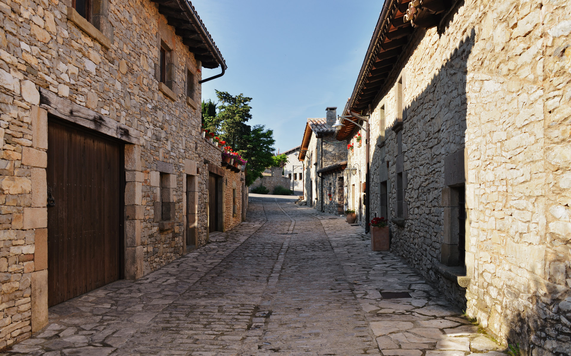
Tavertet village is situated in the Catalonian province, in the region of Guilleries mountains, about 900 meters above sea level. Lying above high cliff, far away from noisy resort towns, it seems separated from the rest of the world. Favorable neighborhood of surrounding nature enhances the unity of Tavertet’s architectural style; all (even new) structures, roads and sidewalks are made in traditional style, with natural materials — stone and wood. Megalithic tombs, funeral urns and Iberian walls testify to 5000-year history of the village. Tavertet’s places of interest are the stone houses built in XVII-XVIII centuries and the Roman church of Sant Cristofol; the ones add more charm to the cliff village: brighten it and make it more fascinating.
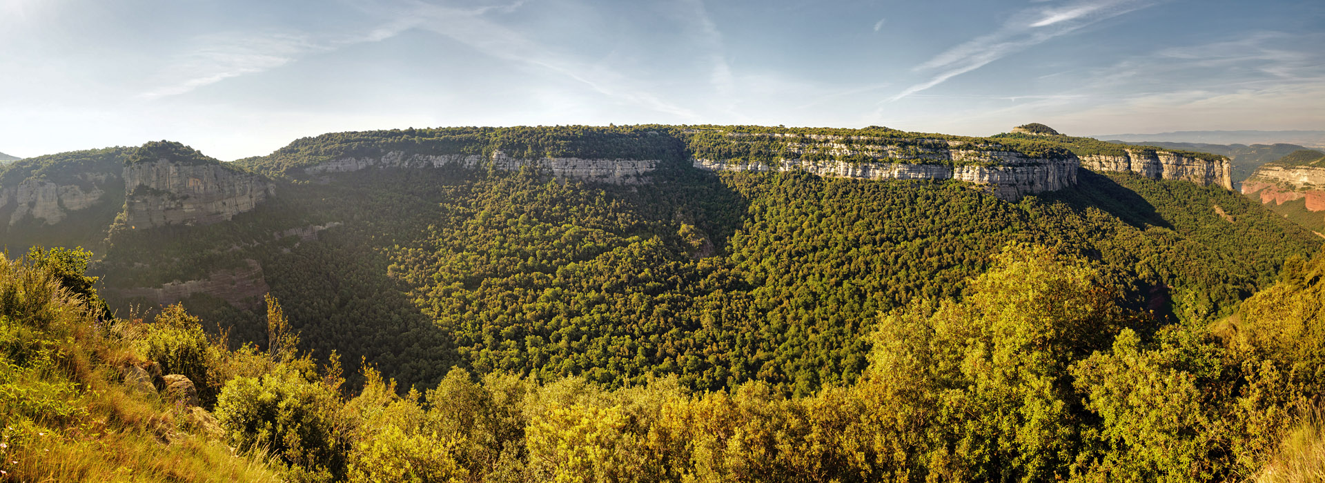
But, despite the beauty, coziness and pleasing view of Tavertet, the main goal of my trip was exploring rock massif near it. There is unusual rocky formation stretches out from the south-west edge of the village; it looks like plateau and consists of three “isles” joined together. Here is the overview of the terrain on Google Maps in 3D mode:
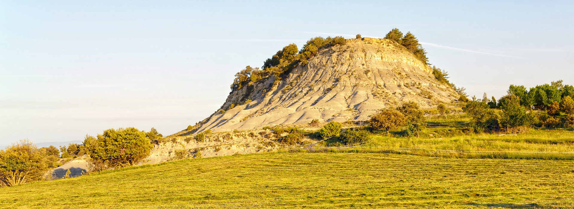
On the peak of the crag one can see the local centerpiece — the small hill that dominates the lonely farm and pastures border on it. Though it wasn’t too high, it turned out that climbing on it was a bit hard, as the hillsides were eroded and the rock was literally strewing beneath my feet.
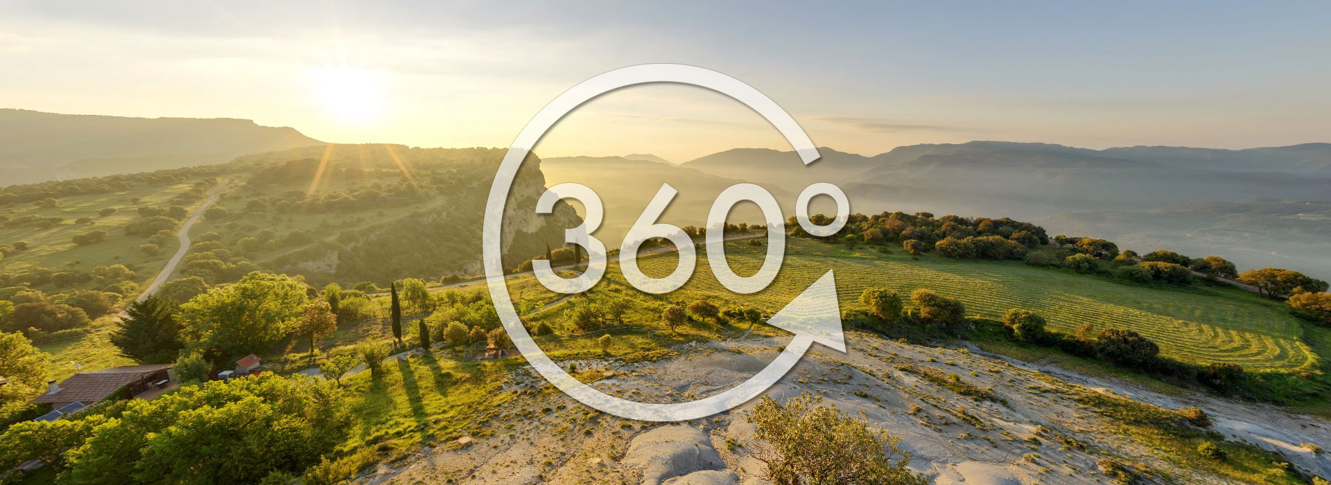
But it was worth spending a time: there was a gorgeous overlook to picturesque landscape from above; I managed to shoot one panorama of the virtual tour from there. Other ones were shot from the southern hillside, just above the steep, where one can see the Ter river and the Sau reservoir.
From my blog:
High-resolution interior panoramas
Meteora - a symbiosis of nature and history
Sardinia - mountains, sea and stars
Morning over the Dalmatian coast